


Download software tagged by polar coordinates
|
The most popular program: Quick Slide Show 2.00

more info |
|
We recommend: DXF Works 1.0
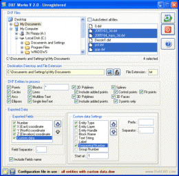
more info |
RapidDXF 3.1 by DeliCAD
2006-08-02
RapidDXF reads ASCII (text) files of coordinates and creates DXF (version 12) files of points and thier attributes. The DXF files so created are usable in many CAD software. RapidDXF can process several files at a time.
Geo Data International Admin 3.03 by C. Killet Software Ing.-GbR
2010-08-06
Geo data international world-wide with towns, town quarters and postal codes. Georeferences as UTM- and geographic coordinates (WGS84) and elevations. Suitable for branch searches, periphery searches and distance computations. dBase, CSV, SDF, SQL.
Geodaten International Houses 3.02 by C. Killet Software Ing.-GbR
2010-08-06
For many countries House Coordinates are present with coverage degrees of 100 percent. The geo data offered here are in high-precision quality and are present in several coordinate and reference systems (Geographic, UTM / WGS84, ETRS89).
Geo Data International Houses 3.02 by C. Killet Software Ing.-GbR
2010-08-12
For many countries house coordinates are present with coverage degrees of 100 percent. The geo data offered here are in high-precision quality and are present in several coordinate and reference systems (Geographic, UTM / WGS84, ETRS89).
Geodaten International Streets 3.02 by C. Killet Software Ing.-GbR
2010-08-10
For many countries street coordinates are present with coverage degrees upto 100 percent. The geo data offered here are in high-precision quality and are present in several coordinate and reference systems.
Geo Data International Streets 3.02 by C. Killet Software Ing.-GbR
2010-08-08
For many countries street coordinates are present with coverage degrees of 100 percent. The geo data offered here are in high-precision quality and are present in several coordinate and reference systems (Geographic, UTM / WGS84, ETRS89).
RapidDXF 4.0 by DeliCAD
2006-10-28
RapidDXF reads ASCII (text) or XLS (Microsoft Excel) files of coordinates and creates DXF (version 12) files of points and thier attributes. The DXF files so created are usable in many CAD software. RapidDXF can process several files at a time.
Geozip 1 by Keskydee
2006-11-30
Geozip calculates distance between US (optionally Canadian) zip codes or geographical coordinates. You can choose miles, kilometers or nautical miles output.
FlashPoints for AutoCAD 1.0 by DeliCAD
2006-12-01
FlashPoints is a tool for creating and managing points Groups (topographic points for example).
FlashPoints allows you to :
* import/export points coordinates from and to a file
* create points and their attributes "Number", "Elevation