


Download software tagged by graphics
|
The most popular program: Quick Slide Show 2.00

more info |
|
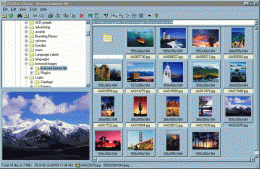
We recommend: ACDSee Classic 1.0
more info |
Print Screen Deluxe 5.2 by American Systems
2005-10-26
Print Screen Deluxe is the ultimate screen capture utility. It provides a fast and easy way to capture, print and save your screen. One keystroke does it all! With one keystroke you can capture and print the entire screen, the current window, & more!
Animated Forests Screensaver 1.3 by Cedar Trails Software
2005-10-26
Artistic animated forests screensaver grows trees with a time-lapse photography effect that never repeats. Comes with 21 beautiful animated forests. Build your own forests with over 30 varieties of trees and many special graphics design effects.
ACD mPower Tools 1.0.2 by ACD Systems
2005-10-26
ACD mPower Tools is a set of handy extensions to Windows and other programs that let you work faster, while staying in the environment you normally use. You don't need to open separate programs to get the benefits of this digital photography software
ACDSee PowerPack 7 by ACD Systems
2005-10-26
ACDSee 7 PowerPack is the essential photo management package for professionals and enthusiasts, Find, organize, edit, print and share your pictures instantly, easier than ever-and with better results. No other photo software saves you so much time.
Canvas GIS Mapping Edition (Mac) 9.0.4 by ACD Systems
2005-10-26
CANVAS 9 GIS Mapping Edition includes direct support for Geographic Information System data. You can take measurements in geographic coordinates, import SHAPE & GeoTIFF files into unlimited numbers of automatically aligned overlapping layers.
Canvas GIS Mapping Edition 9.0.4 by ACD Systems
2005-10-26
CANVAS 9 GIS Mapping Edition includes direct support for Geographic Information System data. You can take measurements in geographic coordinates, import SHAPE & GeoTIFF files into unlimited numbers of automatically aligned overlapping layers.
Canvas GIS Advanced (Mac) 9.0.4 by ACD Systems
2005-10-26
CANVAS 9 Advanced GIS Mapping Edition: Direct support for Geographic Information System data. You can take measurements in geographic coordinates, import any popular GIS file types into unlimited numbers of automatically aligned overlapping layers.
Canvas GIS Advanced 9.0.4 by ACD Systems
2005-10-26
CANVAS 9 Advanced GIS Mapping Edition includes direct support for Geographic Information System data. Take measurements in geographic coordinates, import any popular GIS file types into unlimited numbers of automatically aligned overlapping layers.
ImageFox 2.0 by ACD Systems
2005-10-26
ImageFox 2.0 is a timesaving image and multimedia previewer. It lets you preview files in most Windows Open/Save_as dialog boxes while browsing and without running an external picture viewer or multimedia player. Download ImageFox 2.0 today!