


Download software tagged by publication dapplication
|
The most popular program: Quick Slide Show 2.00

more info |
|
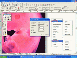
We recommend: Canvas Scientific Imaging Edition (Mac) 9.0.4
more info |
Canvas GIS Mapping Edition (Mac) 9.0.4 by ACD Systems
2005-10-26
CANVAS 9 GIS Mapping Edition includes direct support for Geographic Information System data. You can take measurements in geographic coordinates, import SHAPE & GeoTIFF files into unlimited numbers of automatically aligned overlapping layers.
Canvas GIS Mapping Edition 9.0.4 by ACD Systems
2005-10-26
CANVAS 9 GIS Mapping Edition includes direct support for Geographic Information System data. You can take measurements in geographic coordinates, import SHAPE & GeoTIFF files into unlimited numbers of automatically aligned overlapping layers.
Canvas Professional Edition (Mac) 9.0.4 by ACD Systems
2005-10-26
CANVAS 9 is the high-performance drawing environment for professionals in business, science, and engineering. It seamlessly integrates technical drawing, image editing, page layout, web graphics & presentation features into a single application.
Canvas Professional Edition 9.0.4 by ACD Systems
2005-10-26
CANVAS 9 is the high-performance drawing environment for professionals in business, science, and engineering. It seamlessly integrates technical drawing, image editing, page layout, web graphics & presentation features into a single application.
Canvas Scientific Imaging Edition 9.0.4 by ACD Systems
2005-10-26
CANVAS 9 Scientific Imaging Edition blends native support for advanced imaging and DICOM support with Canvas' full range of vector illustration, image editing, page layout, web graphics, and desktop presentation features.
Canvas GIS Advanced (Mac) 9.0.4 by ACD Systems
2005-10-26
CANVAS 9 Advanced GIS Mapping Edition: Direct support for Geographic Information System data. You can take measurements in geographic coordinates, import any popular GIS file types into unlimited numbers of automatically aligned overlapping layers.
Canvas GIS Advanced 9.0.4 by ACD Systems
2005-10-26
CANVAS 9 Advanced GIS Mapping Edition includes direct support for Geographic Information System data. Take measurements in geographic coordinates, import any popular GIS file types into unlimited numbers of automatically aligned overlapping layers.
3D Photo Builder Professional Edition 2.3 by Anything3D Corp.
2009-07-07
Powerful software for high quality panorama stitching and 3D images composing. It’s equipped with wide range of tools for storage, processing, preview, exporting and WEB publication of 3D graphics
3D Photo Builder 2.0 by Anything3D Corp.
2009-07-07
Powerful software for high quality panorama stitching and 3D images composing. It’s equipped with wide range of tools for storage, processing, preview, exporting and WEB publication of 3D graphics