


Download Tiles2kml 2.31

|
Author: Tiles2kml
Support OS: WinNT 4.x, Windows2000, WinXP
File size: 8.39 Mb
Price: 40$
Languages: English
Release date: 2006-10-20
Published: 2006-11-12
Support OS: WinNT 4.x, Windows2000, WinXP
File size: 8.39 Mb
Price: 40$
Languages: English
Release date: 2006-10-20
Published: 2006-11-12
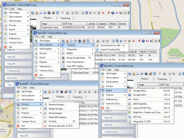
T2K or tiles2kml enables you to efficiently load large set of imagery or raster maps very quickly into GoogleEarth using Region-Based Network Links. This method has an onRegion option, which specifies to load the Region data only when the Region is active. So only the needed set of data is loaded with multiple levels of detail, larger amounts of data are loaded only when the user's viewpoint triggers the next load. Tiles2kml converts your imagery into very small tiles with different level of details allowing very quick view for very large datasets without loosing the image quality. Tiles2kml generate very small image tiles that can be served locally or your PC or your intranet. You can even share your imagery through the internet using the customized kml files that links GoogleEarth client to the small tiles on your webserver. So sharing your large imagery over the internet became a very quick and easy process.
Main Features:
- Large imagery set support
- Region-Based Links
- KML 2.1 Support
- Share large images on the internet without the need for Image Servers
- Multiple input Image format JPG, PNG, BMP, TIF, GIF, GEOTIFF, ERDAS IMAGINE, MrSID and JPEG2000
- Multiple output Image format JPG, PNG, TIF and GIF
- 8, 16, 24 and 32 bits image support
- Export Transparent tiles in GIF and PNG format
- Automatically generate Georefrenced tiles
- Read common world files WLD, JPW, TFW, PGW, GFW, J2W, BPW, SDW
- Ability to Cache to Hard Drives (For Low 'Physical Memory' PC configuration)
- Multiple Project Combination
- Multi Resolution/Scale Image Layering
- Unlimited Images/folders processing
- ESRI Shape files to KML exporter (Including 3D lines)
- Mapinfo (TAB and MIF) files to KML exporter
- Waypoints to KML exporter (GPX1.1 support)
- GoogleEarth Placemark Styles and Description Editor
download
Download free version
Download free version
buy
Buy full version
Buy full version
Related Software
|
We recommend: RoboGEO 2.1
more info |
Tiles2kml Pro 2.31 by Tiles2kml Pro
2007-04-14
T2K Pro integrates the rich world of GIS datasets and transfers your Geographic information data into Google earth.
Plex.Earth Tools for AutoCAD 1.1.317 by Plexscape.com Environmental Web Services
2009-03-17
AutoCAD plug-in for advanced geographic interaction with Google Earth. Cover large areas with color imagery. Geo-locate site plans. Unique productivity tool with “must-have†features necessary for all engineers and architects.
EZ Backup Windows Live Messenger Basic 6.1 by RinjaniSoft
2009-05-02
EZ Backup Windows Live Messenger Basic makes it easy to backup your emoticons, backgrounds, winks, user tiles, moods and message history to any local, network or removable drive.
Link Show (Images) 1.0 by Spriteworks Developments
2006-07-29
Link Show v1.0 (Images) is an easy-to-use and completely customizable preview-type menu system that supports image previews and includes custom cursor support and a variety of border styles.
ManageEngine OpManager 8.0 by AdventNet Inc
2009-03-16
OpManager helps IT administrators manage their servers, services, applications, databases, network links, network devices, VoIP services, and much more using its advanced, in-built fault and performance management features.
Printfil 5.0 -1- by aSwIt s.r.l.
2006-08-02
Allows character based apps (DOS-Windows-Unix-Linux) to print to ANY Windows printer, including USB, network printers, faxmodems and PDF writers. It can also capture LPT out and redirect the jobs, even if a printer is phisically connected to the port
NMEA Converter 1.0 by NMEAsoft
2016-02-11
NMEA Converter is a product to convert various types of data, NMEA to UDP Converter, UDP to NMEA Converter, GPS to HDT Converter, NMEA to KML Converter, NMEA to KMZ Converter, KML to NMEA Converter
Vextractor 6.50 by VextraSoft
2014-09-23
Vextractor is a vectorizer program for transforming raster images to vector formats. This tool could be used for the vectorizing of drawings, maps, photo, logotypes and other line art images for input to CAD, GIS or Vector Graphics Design software.
3D Interactive Kwanza Candles 1.0 by San Diego Screen Savers
2007-06-25
The imagery and messages of the season are demonstrated in 3D with interactive Kwanza candles. Candles light in sequence with individual messages. Later you can extinguish or light the flames by clicking on the candles.